| ||||||||
|
|
||||||||
|
Publications Baskaran, L.M., V.H. Dale, R. A. Efroymson, and W. Birkhead. 2006. Habitat modeling within a regional context: An example using gopher tortoise. American Midland Naturalist 155:335-351. Dale, V.H., D. Druckenbrod, L. Baskaran, C. Garten, L. Olsen, R. Efroymson, and R. Washington-Allen, M. Aldridge, M. Berry. 2005. Analyzing land-use change at different scales in Central Georgia. Pages 1-4 In Proceedings of the 4th Southern Forestry and Natural Resource GIS conference. Athens, Georgia, Dec 16-18, 2004. Dale, V.H., D. Druckenbrod, L. Baskaran, M. Aldridge, M. Berry, C. Garten, L. Olsen, R. Efroymson, and R. Washington-Allen. 2005. Vehicle impacts on the environment at different spatial scales: Observations in west central Georgia, USA. Journal of Terramechanics 42: 383-402. Dale, V.,H., M. Aldridge, T. Arthur, L. Baskaran, M. Berry, M. Chang, R. Efroymson, C. Garten, C. Stewart, and R. Washington-Allen. 2006. Bioregional planning in Central Georgia. Futures 38(4): 471-489. Dale, V.H., F. Akhtar, M. Aldridge, L. Baskaran, M. Berry, M. Chang, R. Efroymson, C. Garten, E. Lingerfelt, C. Stewart. 2008. Modeling impacts of land-use on quality of air, water, noise, and habitats for a five county region in Georgia. Ecology and Society. 13(1) [online]. URL: http://www.ecologyandsociety.org/vol13/iss1/art10/ Efroymson, R. A., V. H. Dale, L. M. Baskaran, M. Chang, M. Aldridge, and M. Berry. 2005. Planning transboundary ecological risk assessments at military installations. Hum. Ecol. Risk Assess. 11:1193-1215. Principal Investigator Other participants Michael W. Berry, Matthew Aldridge, and Murray Browne Michael Chang and Farhan Akhtar Catherine Stewart Eric J. Lingerfelt Background
An important SERDP sponsored workshop on Management-Scale Ecosystem Research identified the significant need for focusing on the health of an entire ecosystem. A way to address this concern is via ecosystem management, which can be defined as “a collaborative process that strives to reconcile the promotion of economic opportunities and livable communities with the conservation of ecological integrity and biodiversity.” There is a critical need for applying ecosystem management approaches to military lands and regions that contain them because of the unique resources on these lands and the fact that conservation issues may jeopardize military missions if not appropriately managed. The Regional Simulator Model (RSim) addresses this critical need by enabling researchers and planners to project outcomes through application of ecosystem management approaches to military lands and surrounding regions by computer modeling.
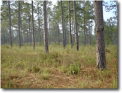
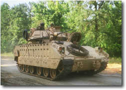
This project was tightly coordinated with the staff at Fort Benning and The Nature Conservancy [who are developing the Integrated Natural Resource Management Plan (INRMP)] for Fort Benning. ObjectiveRSim was designed to integrate environmental effects of on-base training and testing and off-base development. Effects considered include air and water quality, noise, and habitats for endangered and game species. A risk assessment approach was used to determine impacts of single and integrated risks. The plan was to make the simulation environment available via web interface. The model is being used in a gaming mode so that users can explore repercussions of military and land-use decisions. The model is not only a way to integrate existing information (expressed in the form of data and models) and produce environmental planning maps, but it is also a method which promotes collaborative planning. Using the model requires stakeholders to investigate and learn about possible constraints on actions, implications of space and time on environmental decision-making and potential impacts resulting from that decision-making. Summary of Process/TechnologyThe spatially-explicit simulation model was developed for the Fort Benning region, but was structured so that the basic framework can be applied to other installations and their regions. For purposes of this project, the Fort Benning region was defined based on socio-economic factors, the prime drivers of environmental changes in the region. Most impacts focus on Fort Benning or decisions made in its immediate vicinity. The spatially-explicit simulation tool was deployed in a gaming mode so that users can project ramifications of decisions about external land-use change, resource use, and future development policy on the sustainability of military lands and missions (examples).
A formal analysis was conducted to allow users to determine the most appropriate strategy to match their goals. As users simulate conditions from various perspectives, they can determine how making decisions based on different goals affects the environment and mission viability. Potential users of the system include the Alabama and Georgia Departments of Transportation which design and implement new road systems; home owners concerned about commuting, drinking safe water and breathing clean air; the installation commander who must actively train military personnel and test equipment and devices; and other decision makers (e.g., timber company mangers, developers, etc.). The simulation tool is of general applicability to land owners and managers but is of special interest to military planners at DoD installations because of its implications on their training methods and land uses (Urban Growth SubModel Example). BenefitThe research effort was designed to contribute to workable management and monitoring plans. RSim is designed so that it can be incorporated into the existing systems and thus be readily available throughout DoD. In addition, the effort developed new ideas on how to deal with:
Transition Plan
Web-Based Integrated ModelSystem Requirements -- RSim requires the Java Runtime Environment 1.5.0 or higher and at least 1GB of RAM memory. Java installation instructions for Windows, Mac OS X, and Linux/Unix are provided here. Three RSim launch files are provided, for various memory configurations: Small (only 1GB of RAM), Medium (at least 1.5GB of RAM), and Large (at least 2GB of RAM). Using a lanch file larger than the computer's available memory may cause RSim to run extremely slowly, or to stop responding altogether. Running RSim for many timesteps or all of the available models will require either the Medium or Large configuration. In particular, note that the "Apply minimum patch size for suitable habitat" option on Step 7 of 10 in RSim requires at least a Medium configuration. Click on the desired file to run RSim
To request a CD of RSim contact Virginia Dale. AcknowledgementsThe project is funded by a contract from the Strategic Environmental Research and Development Program (SERDP) to Oak Ridge National Laboratory (ORNL). Oak Ridge National Laboratory is managed by the University of Tennessee-Battelle LLC. for the U.S. Department of Energy under contract DE-AC05-00OR22725. | ||||||||
|
Updated: December 2006 | ||||||||
 The United States military is proactive in addressing resource management issues. In response to these issues, the Department of Defense (DoD), the Department of Energy (DoE) and the Environmental Protection Agency (EPA) have collaborated to develop the Strategic Environmental Research and Development Program (SERDP).
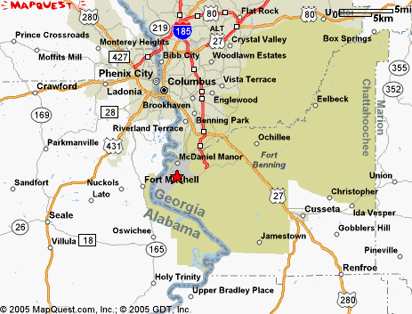
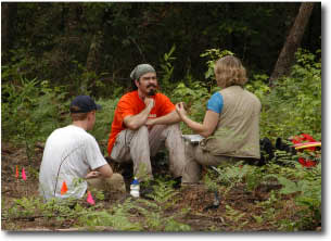
 The project developed a web-based integrated model that can become a part of the ongoing planning effort for the region. Therefore, in the research process we work closely with Fort Benning personnel who are involved in planning and management. The best test of success in this project is to have land managers and planners use the model so that feedback can be obtained (in an adaptive management sense) and incorporated into the model. We worked very closely with the Fort Benning staff and